Covid-19 a entraîné quelques changements dans la façon dont nous organisons nos stages d'orientation, and this affects what you need to bring as well. As far as possible, we’d like you to bring your own materials rather than use stuff we give out, but of course, we don’t want you to have to spend a lot of money on maps and compasses to come on one of our short family or children’s courses.
In general, you’ll need access to some sort of map and compass, a pen(cil) and paper, plus suitable outdoor clothing and footwear for the length of the course and food and drink. In the past, we have given out printed paper maps, but the current guidelines suggest we don’t do this. Instead, we’ll ask you to print out your own maps before the course. If you can’t do this, we will still be able to provide printed materials, but we suggest that you bring a plastic wallet/sleeve to keep it in so you only have to touch it once.
Stage d'Orientation familles et enfants aux Deux Alpes
You’ll need to bring the following items on the day:
- Maps (you can print these yourself – see below)
- Boussole (n'importe quelle boussole nous convient, y compris une application de boussole sur un portable)
- Stylo
- Papier
- Vêtements d'extérieur adaptés à la météo du jour
- Un goûter/snack
To avoid handing out materials on the day, we’d appreciate it if you can print out the maps we’ll need and bring them along. Please print out and bring these two maps using the GeoPortail site (both links will open in a new tab).
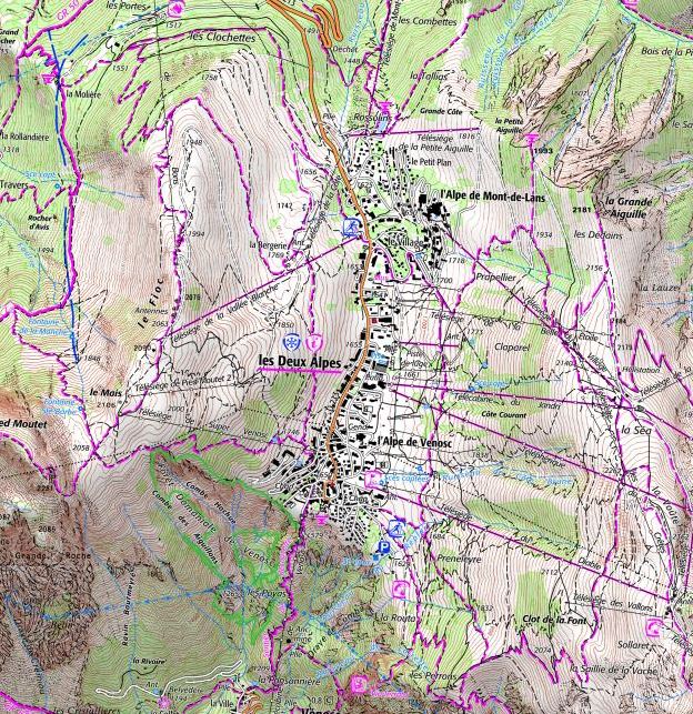
Les Deux Alpes sud, à plus grande échelle
Les Deux Alpes, à plus petite échelle
Idéalement, changez l'échelle à 1: 25000 avant d'imprimer la seconde. Pour ce faire, cliquez sur l'échelle (le 17 055 en bas à gauche) et tapez 25000 à la place.
If you don’t have a compass, you can download a compass app for most smartphones. As long as it tells you where north is it is good enough. If you don’t have a compass or a suitable phone, we will have a couple of spare compasses available to use at your own risk.
La majorité du cours se déroulera à l'extérieur avec quelques petits éléments intérieurs. En cas de tres mauvais temps, nous nous déplacerons à l'intérieur.
Stages d'orientation de deux jours
You’ll need to bring the following items on the day:
- IGN Top 25 map for the area – either 3336ET Les Deux Alpes, 3335ET Bourg d’Oisans or 3630OT Chamonix
- A4 paper maps (you can print these yourself – see below)
- Boussole
- Stylo
- Stylo ou crayon
- Papier
- Vêtements et chaussures adaptés pour une randonnée d'une journée
Pour le stage NNAS Bronze, nous prêtons normalement des boussoles et des cartes IGN aux candidats qui n'en ont pas. Cependant, pour réduire les contacts, ce sera bien si vous utilisiez des cartes imprimées sur du papier A4 et une application de boussole pour smartphone. Si vous assistez à un stage NNAS Silver, vous devriez apporter votre propre boussole et votre carte IGN.
Cartes pour les stages NNAS
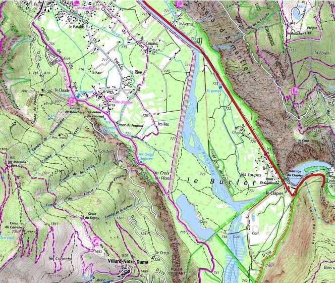
Cartes imprimables pour Les Deux Alpes
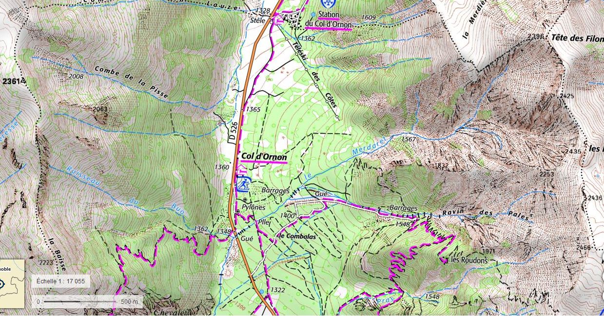
We may visit the permanent orienteering courses at either Auris or the Col d’Ornon. In this case, you will need to print out the orienteering maps for these locations. We will let you know before the course if this is necessary.
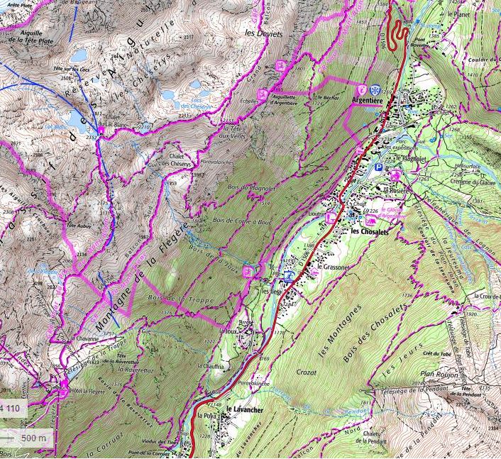
Cartes imprimables de la vallée de Chamonix
Bourg d’Oisans
Pour le stage Bronze uniquement, merci d'imprimer la carte à grande échelle (1) et la la carte à grande échelle (2) of the area south of Bourg d’Oisans. You will also need to print the Adult “Sportif” orienteering map which is the second of the three PDF links sur cette page..